A class I programmed in Java to help me find the radii of the satellites' footprints.
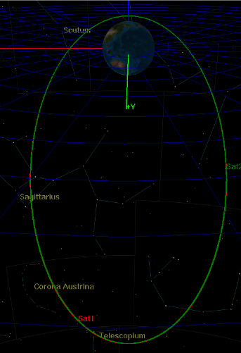
The objective of the project is to provide a satellite model that shows seamless communications with the South Pole and the rest of the world, which will be made using NASA’s General Mission Analysis Tool (GMAT). As a general outline of the model, 2 satellites are put in an elliptical orbit such that while 1 is providing communications, the other is going around the world. If my model ended up being implemented in real life, researchers in the South Pole would have access to the internet. This could be of huge help in emergency situations, in providing clarity in the scientific community, and in improving the quality of life for researchers based in the South Pole.

A class I programmed in Java to help me find the radii of the satellites' footprints.

The first model I made.