Research - Non-point source runoff and surface water quality in urban streams
Background
Objectives and methods
The objective of this work was to illustrate how watershed characteristics, field monitoring, sediment characterization, and hydrologic modeling can be combined to quantify loads entering a urbanized pond. A combination of watershed characterization, hydrologic model development, field measurements, and bottom sediment characterization was used to quantify flows and volumes and sediment loads entering the pond. Field measurements were obtained to characterize dry weather conditions and complete distributions of specific stormwater events. Laboratory protocols and analyses (e.g. total and volatile suspended solids, benthic sediment analyses, etc.) which were completed with assistance from D. Pellegrino, our laboratory technician, followed standard approaches (e.g. Standard Methods by Clescerl et al., 2002). Some of the metals results (characterized using an atomic absorption (A/A) spectrophotometer), are not shown here.
The HydroCAD software package, which includes algorithms for applying Natural Resources Conservation Service (NRCS) methods, was used to simulate runoff for specific storm events. Watershed characteristics provided basin parameters (e.g. runoff coefficients and times of concentration), and the basin was discretized to represent the effects of ponds the the nature of the drainage system as closely as possible.
Next steps
The next steps include refining and determining the applicability of these approaches, addressing organics, enhancing the modeling approaches to include sediments, metals and other contaminants, and using them to development BMP solutions. These issues are being addressed for other watersheds. These projects provide ideal mechanisms for introducing field and modeling experiences into the undergraduate and graduate curricula.
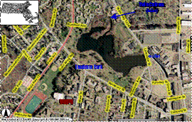


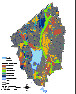

Figure 3 - Schematic of modeling approach
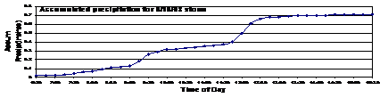

Figure 4 - Estimated Bathymetry
Some results & implications
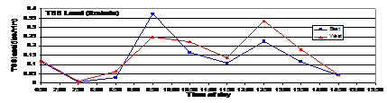
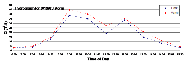
Examples of some of the data collected are shown in Figure 4. The data were used to refine the hydrologic model and understand loads and sediment transport for various conditions. By effectively integrating watershed characteristics (in terms of a GIS), field measurements (for dry and wet weather conditions), with pond bottom sediment characteristics and hydrologic model results, flowrates, sediment loads and contaminant loads can be estimated. These estimates can then provide a stronger basis for developing and evaluating BMP solutions.